Clayton’s GIS Team Keeps the Town on the Map
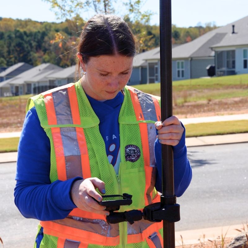
Most people may not realize how much Geographic Information Systems, or GIS, impacts daily life. Megan Palmer, GIS Technician for the Town of Clayton, helps create maps and tools that support everything from utilities to public safety.
She has assisted with updating web mapping applications that residents can access through the GIS homepage and recently created a multi-page map series for the Fire Department to help new staff learn about streets and fire planning districts.
“There is really something new every day,” said Palmer. “I enjoy working on different projects at once, and I love knowing that the work I do makes a difference for the Town and its residents.”
Palmer’s path to GIS began with her undergraduate degree in geology, which helped her develop the skills to understand complex landscapes and data.
“In my last year, I took a GIS class and really got interested in it,” she said. “I wanted to combine GIS and geology, so I went to grad school to continue that focus.”
Before joining the Town, Palmer completed an internship with Johnson City Water and Sewer Services, gaining hands-on experience with mapping utilities and infrastructure. She initially commuted an hour for this type of role, but she fell in love with Clayton and eventually moved to the Town to make it her home.
“I just loved the community,” she said. “Clayton felt like the right place to live and grow my career.”
At the Town, Palmer manages GIS data for water, sewer, and stormwater services. She verifies where new infrastructure will be installed, updates GIS records after installation, and maintains accurate mapping of utility assets such as water meters and manholes. Electric services are also mapped in GIS, though they are managed by the Electric Department.
“Knowing exactly where our assets are is crucial,” explained Palmer. “It helps us plan, respond to emergencies, and provide services efficiently. Residents can even see some of this information on our public-facing maps.”
GIS also connects projects beyond utilities, playing a role in how the Town plans, stays safe, and serves the community.
“GIS is integrated into so many places that people do not realize,” said Palmer. “At the end of the day, it is often just a map, but those maps are everywhere. And they make a big difference.”
The Town of Clayton is celebrating GIS Day on Wednesday, November 19, honoring the technology and the staff behind it. Palmer’s work keeps the Town’s geographic information accurate and accessible for residents and departments.